Welcome to Transit + OSMnx’s documentation!
“Transit + OSMnx”
by Filip Wodnicki
Final project submission for:
Harvard Extension School
Advanced Python for Data Science (CSCI E-29)
Spring 2021
Domain: transportation, public transit, urban planning, networks, graphs
Bottom line: Networks and multimodal routing!
Google Maps |
Transit + OSMnx |
|---|---|
|
|

On the left are these google map directions, on the right are the same multi-modal transit directions built with transit + osmnx.
Project Links
Presentation video (Section 5 May 2021, 1:30PM EST) Harvard Extension access only
Piazza post Harvard Extension access only
Documentation Pages
Cool features of this documentation
Autodoc
Markdown-based, rather than .rst
Parsing ipynb notebooks (using myst-nb library)
Google docstring style via Sphinx Napoleon
Transit + OSMnx
Objective
Build a multi-modal walking and transit network, with Python, open source libraries, and open data.
Getting started
Basic usage
make data
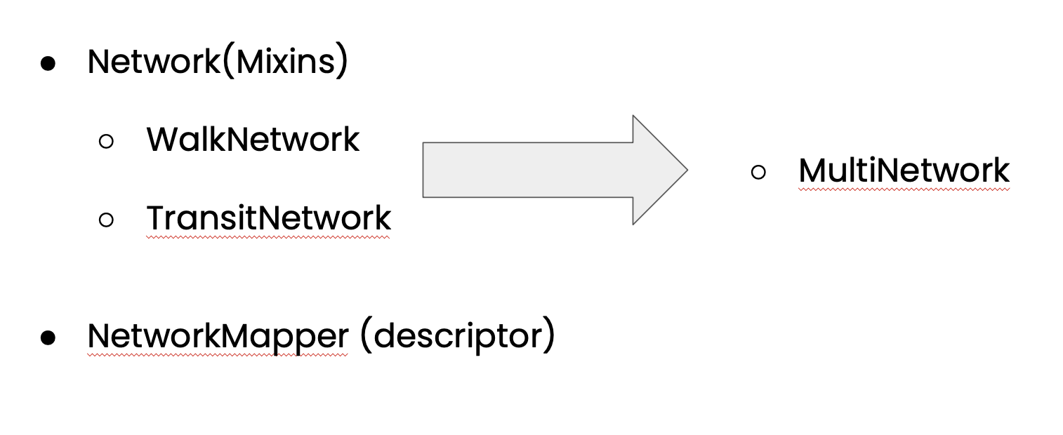
from final_project import WalkNetwork, TransitNetwork, MultiNetwork

# Make a MultiNetwork
W = WalkNetwork.create_from_name("Boston")
T = TransitNetwork.create_from_gtfs("data/MBTA_GTFS.zip")  # Uses the GTFS from Makefile
WT = MultiNetwork.combine(walk=W, transit=T)

# Map it
m = WT.mapper
m

# Route on it!
BOS_airport = (42.36924490636996, -71.02041230759893)
harvard_DCE = (42.375019663272305, -71.12022229636055)

shortest_route, shortest_dist = WT.get_shortest_pair(origin=BOS_airport, dest=harvard_DCE)
Installation
conda install -r requirements.txt
git clone https://github.com/csci-e-29/2021sp-final-project-filipwodnicki.git
Background
The python library osmnx introduced the ability to easily download OpenStreetMap (OSM) data and build a queryable networkx graph of a) road, b) walking, and c) bike path networks for analysis. However, OSM is a limited and incomplete source of data on actual public transport services. In contrast, libraries like peartree and pandana create spatio-temporal models of public transport systems based on GTFS schedule data. However, these libraries don’t integrate those public transport models back into the surrounding walking and biking networks, leaving them out of context of the greater urban fabric.
Approach
Explore.
Solve.
Refactor.
Deliverables
Library
See the Code Reference and repo
Demo
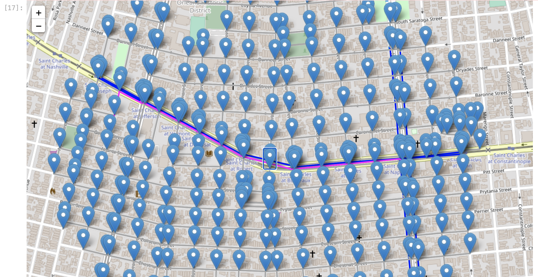
See Demo.ipynb where we walk through combining the walking and transit networks of New Orleans.
Architecture
Advanced Python
Please see the writeup on concepts used here: Discussion - Advanced Python Concepts.
Conclusion
The main contribution of this project is a toolkit for solving a real-world problem routing in new ways. The mission of building a Multi-modal Transit+Walking graph was achieved! An R&D process (Explore, Solve, Refactor) came out of this project.
Acknowledgements
Thank you Prof Gorlin and teaching staff. I dreamed of doing projects like this for fun. And now, I can(!!)
Future
But it’s not the end! Here are some ideas for next steps:
Address WIP: namely testing
Contribute to osmnx or Peartree
Scale Pandas operations via Dask - How could be build and store a MultiNetwork for the whole world!?
Build out visualization - e.g. time isochrone of places accessible within 15 minutes
Expose routing as API via Django
And more…